The Enhancement Of Treasure Island.
An Assignment For The College Diploma In Upland Resource Management - by Frank Waller.
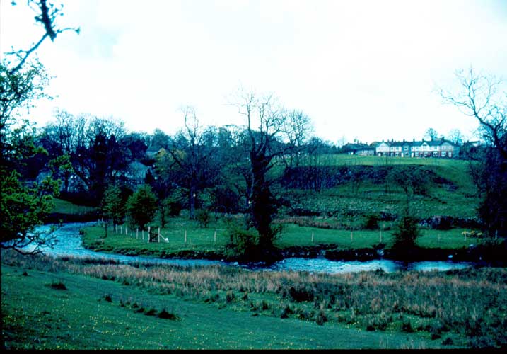
"Treasure Island" is a small piece of land a little over half an acre (0.23 ha) bounded by the river Aire on three sides and a boundary drystone wall with a high embankment on the west side. It is situated on (O.S. Map SD 904594) at a height of 160M (525ft) and lies due north of the old Airton mill, now converted into nineteen flats, and is accessed via a public footpath on top of the high enbankment.
The land, before it was purchased on 5th September 1991, was left very much to its own resources and in a wild and derelict state, only grazed occasionally when sheep and cattle could ford the river in late spring and summer months.
The long distance footpath - the Pennine Way - runs parallel to the river on the opposite bank and walkers along this footpath can easily look down on "Treasure Island".
Although it is not an island in the true sense of the word, it has been aptly named as the land is completely isolated by the river and the embankment.
Treasure abounds in the wealth of wild life, flora and mature trees and there are in effect five distinct habitats encompassed on this land:
- 1. The river and river bank
- 2. The flat meadow land
- 3. The bog, wetlands & dug area
- 4. The wall
- 5. The waterfall
Read the full version HERE